Explore the Munros – Schiehallion
Enjoy this excerpt on Schiehallion from ‘Explore the Munros’, our guide to 50 of Scotland’s most iconic mountains.
Schiehallion
Pronunciation: Shee-hally-yan
Meaning: fairy hill of the Caledonians
Height: 1083m (3553ft); Rank: 59
OS Landranger Map 51
Summit grid ref: NN713547 (small cairn)
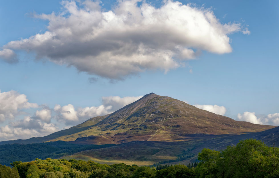
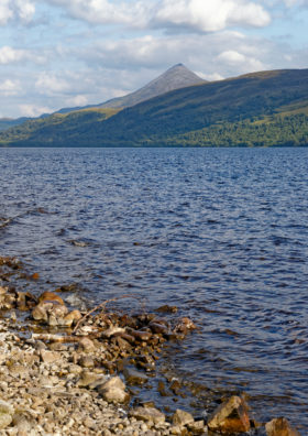
Its shape, location, name, folklore and history all combine to make Schiehallion one of Scotland’s most iconic mountains. It’s a lonely peak, unconnected to any others. From the south particularly, it’s a broad whaleback of a hill. From other vantage points, especially across Loch Rannoch and the north-west, it’s
wonderfully conical in shape. It’s like the perfect mountain from a child’s picture book.
Schiehallion’s isolation, stature and unmistakable profile make it one of the easiest mountains to identify. Indeed, given its position in almost the dead centre of the country, probably no hill is as visible from as many other hills as Schiehallion. The mountain’s isolation and highly regular shape meant it was the ideal location for experiments in the late 18th century to measure the mass of the Earth. It was during this work that the concept of contour lines was developed. Something for which all hillwalkers, climbers and ramblers owe a debt of gratitude.
The hill’s mystique
The romance of its name – Schiehallion, the fairy hill of the Caledonians – lends the hill a mystique that alone is enough to draw visitors to its flanks. The upper part of the mountain consists of hard white quartzite. The lower parts are limestone and contain many caves – particularly on the southern slopes. There are many myths and legends associated with the mountain and its caverns. One – Uamh Tom a’ Mhor-fhir, or Cave of the Hill of the Big Man – was said to be the entrance to the land of the fairies. It’s no surprise such an interesting hill is also a very popular one. Whatever time of year you climb it, you’re likely to have company.
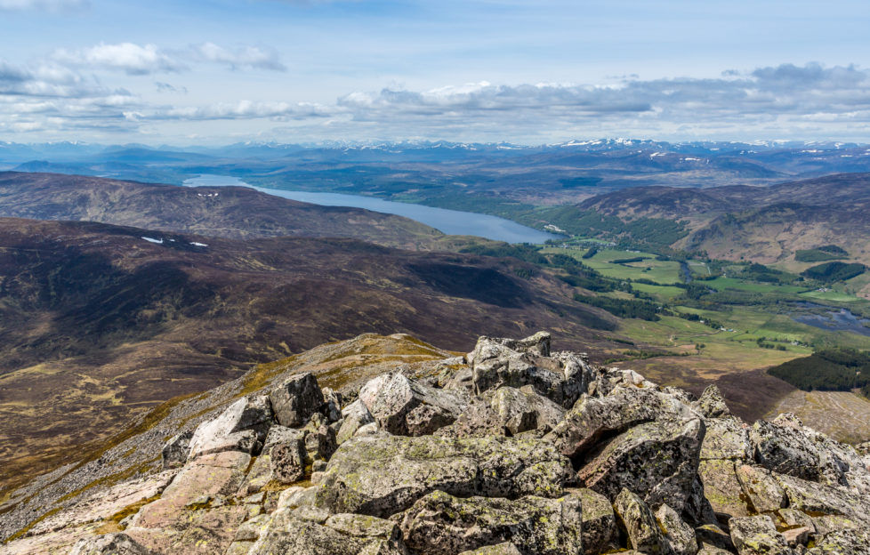
With easy access, a good car park at Braes of Foss and an excellent path most of the way up, Schiehallion is a straightforward, relatively easy Munro. The upper part of the hill, however, is a massive boulder field consisting of huge rocks. This can make going quite tough. The summit has a small cairn perched on a rocky outcrop and the views are immense. A short distance north-east lies Beinn a’ Ghlò. Even more impressive is the view west, to the dramatic peaks of Glen Coe, rising sharply beyond the flat, watery expanse of Rannoch Moor.
The Schiehallion Experiment
For 17 rain-soaked weeks through the summer of 1774, Astronomer Royal Nevil Maskelyne lived in a bothy on Schiehallion. He was attempting to calculate the mountain’s mass, and thus determine the density of the Earth. Today, it’s known as the Maskelyne, or Schiehallion, Experiment. It involved carefully measuring the mountain to work out what proportion of the Earth it represented – this could be done as the circumference of the planet was already known.
Schiehallion was selected as its regular shape meant it was relatively easy to measure. Charles Hutton was the man charged with measuring the mountain’s volume. He worked out it was easier to first measure regularly shaped “slices” of the mountain, and add their volumes together. These slices became the contour lines familiar to all hillwalkers today. The mass of the mountain was worked out using pendulums, as the gravitational pull of the hill tugged a plumb weight slightly out of true. Using this angle to calculate the mass of the hill, it was then a case of extrapolating the figure to give the density of the Earth. The figures were pretty accurate – 4500kgm-3. Today it’s recorded as 5515kgm.
The Route
Shapely Schiehallion – try saying that after a few – can be climbed from pretty much any direction. The crags and outcrops on the flanks easily avoided. However, the route I’d recommend is from the Braes of Foss car park on the excellent path constructed by the John Muir Trust a few years ago. Prior to this work, the route from here up this enormously popular hill had worn an ugly, wide scar on the landscape. It was muddy, steep, slippery and badly eroded.
The Trust bought the eastern side of the mountain, including the summit, in 1999. They subsequently spent around £800,000 on the new path, which follows an older line up the hill, and have also undertaken lots of work to restore the old route. In time it should heal leaving no trace. The path leaves Braes of Foss and heads up Schiehallion’s long east ridge. It’s not waymarked, but the route’s simple to follow. The superb track makes going easy and the ascent is quick, the views improving as height is gained.
‘An enormous summit boulder field’
The track ends at a large cairn roughly at the start of the enormous summit boulder field. The walking here becomes very rough, the route twisting among and over massive quartzite rocks and boulders – care should be taken, and this stony section seems to go on much longer than you first expect. I think this section of the walk is far more pleasant in late winter or spring, when the angular boulders are buried under a decent covering of consolidated snow. If you’re a winter walker, with the appropriate equipment and experience, this is a great choice for a short day. Simply reverse the route to return to the car park, on the JMT path.
Some walkers don’t like such prescribed, maintained routes. The feeling being perhaps that constructed paths make access too easy and detract from the “wildness” of an area. While that’s a view with which I have some sympathy – certainly in our more remote areas – on a hill as popular as this, it’s just not practical. The damage and erosion caused by many thousands of feet is clear to see on too many of our hills. Here, the JMT have put a lot of money and work into restoring the land on the flank of this iconic mountain – we should support their efforts by sticking to the path.